Location:
Travel one mile east of Cottage Grove on Row River Road. Follow the sign to Mosby Creek Road, turning right and crossing the railroad tracks. Turn left (south) on Mosby Creek Road and travel approximately 3.5 miles to Garoutte Road.
Background:
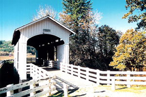
As with other wooden bridges in Oregon, the Stewart Bridge has had its share of woes. Heavy rains of the 1964 "Christmas Flood" brought water raging down Mosby Creek with the resulting force cracking the lower chords of the bridge.
Just over four years later, a heavy snowstorm dropped more than three feet of snow on most of the Willamette Valley. The roof bracing gave way under the weight of the snow, and the entire roof caved in.
Repairs to the bridge once again made it usable, and it carried a 20-ton limit until it was bypassed in the mid-1980s by a concrete span.
The Stewart Bridge was officially "mothballed" in 1987, with one of the approaches removed, fumigation of timbers, and installation of a wire fence inside a portal for safety of pedestrians.
In the 1993-95 biennium, the Lane County received a grant of around $48,000 from the Oregon Covered Bridge Program to restore the bridge.
County: Lane
Stream: Mosby Creek
Latitude: 43°45'57.5"N
Longitude: 122°59'38.9"W
Truss Type: Howe
Bridge Length (ft): 60
Year Built: 1930
World Guide Number: 37-20-28