Location:
From Interstate 5 exit 238 and travel east to Jefferson. Just east of the arch bridge over the Santiam River, turn right on South Main Street and continue until the street turns into Jefferson-Scio Drive. Continue east towards Scio and turn right (south) onto Robinson Drive. As Robinson Drive curves east, turn right on Goar Road and travel 1.5 miles to the bridge. Alternately, travel one-half mile south of Scio on Highway 226, then three miles west on Gilkey Road. Turn north on Goar Road and travel 0.5 mile to the bridge.
Background:
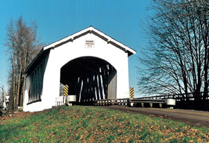
The Gilkey Bridge spans Thomas Creek and until 1960, it proudly stood next to a covered railroad bridge.
Gilkey was once a town of some activity, as noted by a nearby sign: "Gilkey Station was established when the railroad arrived in 1880 and was named in honor of Allen and William Gilkey. Gilkey served as a shipping point for farm products."
Just about all but the sign and the bridge are now gone, and the sign is totally faded. The familiar swimming rope is tied to the framework of the bridge, and during the summer swimmers enjoy this area of Thomas Creek. Youngsters often grow tired of swinging on the rope and seek more excitement by climbing up to the roof and jumping into the cool water below.
In 1997, the bridge had to be closed due to damage caused by an overloaded vehicle. The load had overstressed the bridge and broke the timber shear keys in some of the lower chord joints. Temporary cables were installed to keep the bridge up under its own weight.
Permanent repairs were designed and constructed in 1998 and the bridge was reopened to traffic.
County: Linn
Stream: Thomas Creek
Latitude: 44°41'16.4"N
Longitude: 122°54'11.9"W
Truss Type: Howe
Bridge Length (ft): 120
Year Built: 1939 *1998
World Guide Number: 37-22-04