A spectacular desert rock-climbing site surrounded by the looping Crooked River
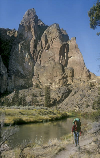
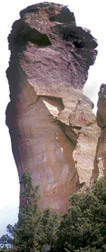
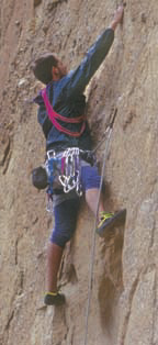
About the Hike: Smith Rock juts from the Central Oregon lava plains like an orange-sailed ship in the desert. Oregon's most popular rock-climbing area, this state park challenges mountaineers with 3 miles of rhyolite cliffs and Monkey Face, a 350-foot-tall natural sculpture. Hikers can experience Smith Rock's scenic drama too. For an easy trip, walk along the aptly named Crooked River as it curls past the base of Monkey Face. For a steep shortcut back, climb steps to cliff-edge views of the High Cascades.
Difficulty: A moderate, 3.6-mile loop to the headland's tip gains 900 feet of elevation.
Season: Open all year. The area is best in spring, when high desert wildflowers bloom, or in winter when other trails are blocked by snow. Just avoid July and August when the park bakes in 100-degree heat.
Getting There: Drive Highway 97 to Terrebonne, 6 miles north of Redmond or 20 miles south of Madras. Following "Smith Rock State Park" signs, turn east for 3.3 zigzagging miles to the parking area.
Fees: A $3-per-car fee is charged here. It can be paid with bills or coins at an automat in the parking lot.
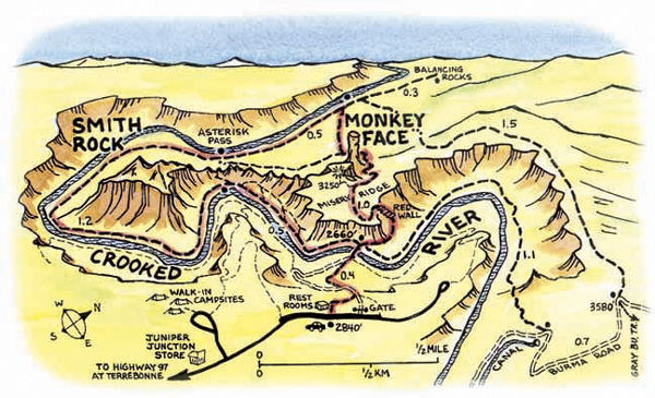
 Hiking Tips: Park near the restrooms and walk to an overlook at the far right end of the picnic area. Follow a gated dirt road down through an aromatic stand of tall sagebrush, cross the river bridge to a trail junction and turn left along the riverbank. You'll soon round a bend and come to three side trails signed for The Dihedrals and Asterisk Pass; these climb up stairs and end at cliffs where climbers dangle, jangling their gear. Explore these side trails, if you like, by hiking up one and descending on the next.
Then continue down river, watching the plentiful bird life. Black-and-white magpies swoop from gnarled junipers. Pigeons coo in rock cracks. The eagles who hunt these birds soar from aeries high on the cliffs. At the 2-mile mark the trail rounds the tip of a peninsula and soon offers the first view ahead to M onkey Face. Look for climbers resting in the mouth cave.
When the trail passes below Monkey Face you'll reach a junction. For the steep shortcut back, turn right and climb steps to a ridge, where views extend to peaks from the Three Sisters to Mount Hood.
If you're not afraid of heights, you can take a side trail down to the right to a precipice opposite Monkey Face's cave-mouth. Otherwise continue straight on the loop trail, contouring 200 yards to the edge of Misery Ridge. Here several steep staircases have taken the misery out of the switchbacking descent to the Crooked River footbridge.
Geology: The western vanguard of the Ochoco Mountains, Smith Rock is formed of welded rhyolite ash. This ash erupted from the Old Cascades, settled in a large inland sea, and fused to form rock by heat and pressure. The resulting rock is popular with climbers because it does not crumble easily. More recent lava flows pushed the Crooked River up against Smith Rock and left the basalt rimrock of the river's south shore.
By William Sullivan
