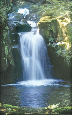
Explore a creek with a dozen small waterfalls, following a trail on catwalks bolted to the cliffs
About the Hike: Just a few miles inland from Florence, the waterfalls of this dramatic Coast Range gorge are accessed by an easy trail. Visit in April or May to see woodland wildflowers, including big white trilliusm and a rare breed of pink fawn lilies.
Difficulty: The easy, 2.2-mile round-trip trail to Sweet Creek Falls gains just 350 feet of elevation.
Season: Open all year.
Getting There: Drive Highway 126 to the Siuslaw River Bridge in Mapleton (15 miles east of Florence or 46 miles west of Eugene). Cross the bridge from town and immediately turn west on Sweet Creek Road for 10.2 paved miles. Then take a paved turnoff to the right to the Homestead Trailhead turnaround.
Fees: Recreation Fee Pass (Northwest Forest Pass) parking permits are required at the trailhead. They cost $5 per car per day or $30 per season.
Hiking Tips: From the Homestead Trailhead, the graveled path heads upstream past a split, 10-foot waterfall. Later, the trail hugs a cliff through a canyon full of punchbowl-shaped falls. Four-foot-thick Douglas fir trees tower above the creekside alder and bigleaf maple.
 After 0.7 mile a path from a second trailhead joins on the left. Continue upstream 0.4 mile to a cliff-edged plunge pool at the base of 20-foot Sweet Creek Falls. A spur trail switchbacks up 150 yards to a viewpoint of an upper falls in a thundering slot.
If you'd like to explore the valley's upper reaches, hike back to your car and drive the paved road 1.3 miles beyond the Homestead Trailhead. Just after a bridge, park at the Wagon Road Trailhead on the left. Across the road, a path heads downstream 0.8 mile to a different viewpoint of Sweet Creek Falls.
A nearby 0.6-mile trail to Beaver Creek Falls is also nice, and very quiet. From the Wagon Road Trailhead, walk across the road's bridge to find a Sweet Creek Trail sign on the right. This portion of the path heads upstream to the base of a fan-shaped waterfall where Beaver Creek and Sweet Creek merge.
 History: The valley here was settled in 1879 by the Zarah T. Sweets, a family of Oregon Trail pioneers. The modern trail incorporates portions of an early wagon road.
Geology: The Coast Range in this area consists of mudstones, sandstones and an occasional basalt flow. All of this rock belongs on the seafloor of the Pacific Ocean. It has been brought to the surface only by a quirk. The North American continental plate has been advancing westward across the Pacific, at the rate of about an inch a year, for quite some time. About 30 million years ago a chunk of Pacific seafloor buckled up in front of the advancing continent and decided to become land, creating Oregon's Coast Range and the terrain you see here along Sweet Creek.
By William Sullivan
