Location:
Attractions: Covered Bridges
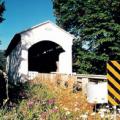
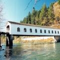
Location:
From Interstate 5 take Highway 58 east to Lowell. Alternately, from Unity follow Jasper-Lowell Road about 3 miles to Highway 58. Lowell is on the south side of Dexter Lake.
Region: Willamette Valley
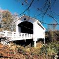
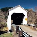
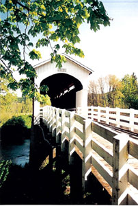
Location:
From I-5 exit I-105 east to Marcola Road. Follow Marcola Road approximately 14 miles. Earnest Bridge is located on Paschelke Road.
Region: Willamette Valley
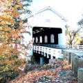
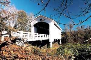
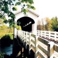
Location:
Travel five miles east of Cottage Grove on Row River Road to the junction of Government Road. Continue east on Government Road seven miles to the bridge.
City: Cottage Grove
Region: Willamette Valley
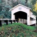
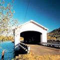
 Location:
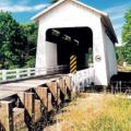
Pages
Covered Bridges of Oregon
|
What is a "World Guide Number?" Local naming of covered bridges can prove to be inconsistent, and many bridges have more than one name. Each bridge in this section has a unique identification called a World Guide Number. This system of identifying covered bridges on a national scale was developed in the 1950s and has been adopted by the National Society for the Preservation of Covered Bridges. The assigned World Guide Number for each bridge is the combination of a state, county and bridge identifier. Oregon, being the 37th state alphabetically, dictates the first two digits of the identifier. The counties are also assigned numbers in alphabetical order. All bridges in Benton County, for example, contain the number 37-02- because Benton County is the second county in the state alphabetically. The third set of numbers are assigned to the actual bridge location, although the name of the bridge or stream is not a factor in the assignment. Many bridges have been destroyed since the adoption of the World Guide Number. Since the number is not reused or reassigned, some numbers are missing. Combinations of numbers and letters denote a bridge which does not use a true truss for support but is covered nonetheless.
Information included in this section was provided by Bill Cockrell, who with his brother Nick authored "Roofs Over Rivers" and is presented here in cooperation with the Covered Bridge Society of Oregon. |